Where maps were static, now they are dynamic. Where before we turned the page of an atlas, now we pan and zoom our way around a screen.
The first interactive map was developed in 1993 by Steve Putz at Xerox PARC. The Interactive Map Viewer automatically generated GIF images based on parameters encoded in the URL. It was an early demonstration of interactive information retrieval on the Web.
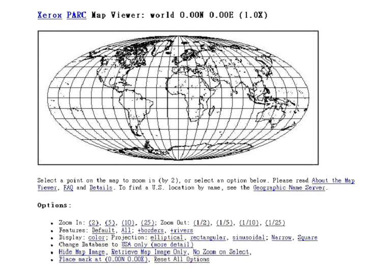
Xerox PARC Map Viewer 1993
In 1994, at the University of Minnesota, researcher Stephen Lime created UMN MapServer, a Web-based tool for exploring a million acres of wilderness on the Canadian border. The area was under the administration of the US Forestry Service. They saw the potential of Lime’s tool to plot global forestry information. After securing funding from NASA and the European Union, UMN MapServer became the first platform for the remote accessing of satellite imagery. Its job done, Lime and the University of Minnesota made MapServer open source. The map generation engine is used to this day to track hurricanes, plot shipping routes and plan bicycle trips.
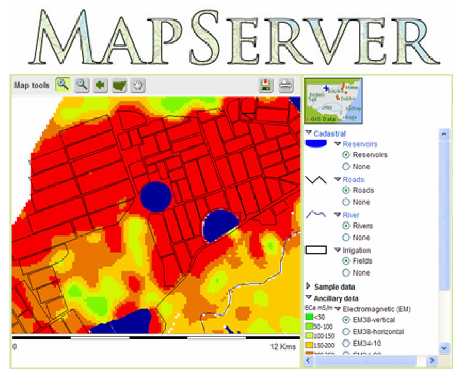
MapServer 1994
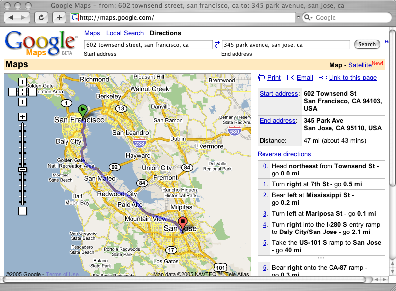
The first commercial Web map was developed by the Chicago based company, R.R. Donnelley & Sons, who had been making roadmaps since the 1960s. Their online route-finding software, MapQuest, launched on 5th February 1996. Direction finding would never be the same again. The same data used to power MapQuest, now powers Google Maps.
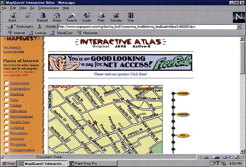
MapQuest 1996
Perhaps one of the biggest success stories in the world of web mapping is OpenStreetMap. Developed in 2004, by Steve Coast, his aim was to create Wikipedia for maps. He was convinced a crowdsourced geographic database would be a useful way to keep maps up-to-date. He was right. Since its inception, OpenStreetMap has benefitted from over 300,000 contributors and has been adopted by Apple, CraigsList, Flickr and FourSquare.
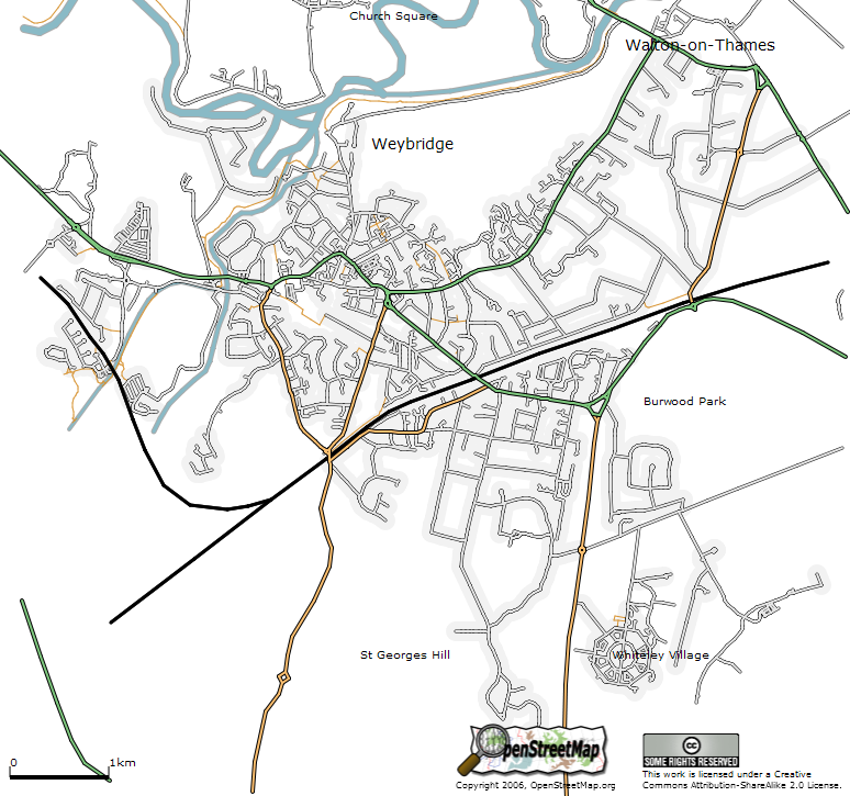
OpenStreetMap 2004
The Web map of choice for millions of users is Google Maps. Beginning life as an offline program designed by two Danish brothers, Lars and Jens Rasmussen, after 6-months in beta, the Web-based version officially became part of Google Local on 6th October 2005. The impact of Google Maps goes far beyond online mapping. Its use of Asynchronous JavaScript and XML (AJAX) created a seamless experience that inspired the next generation of websites. Without Google Maps, we would not have Web 2.0.
Google Maps 2005
Thanks to pioneers like the UMN MapServer, MapQuest and OpenStreetMap, maps are no longer about geographical landscapes, they are about data. Every day, they become more comprehensive, more accurate and more useful. Maps are becoming increasingly realistic but perhaps more interestingly, reality is becoming more like a map.
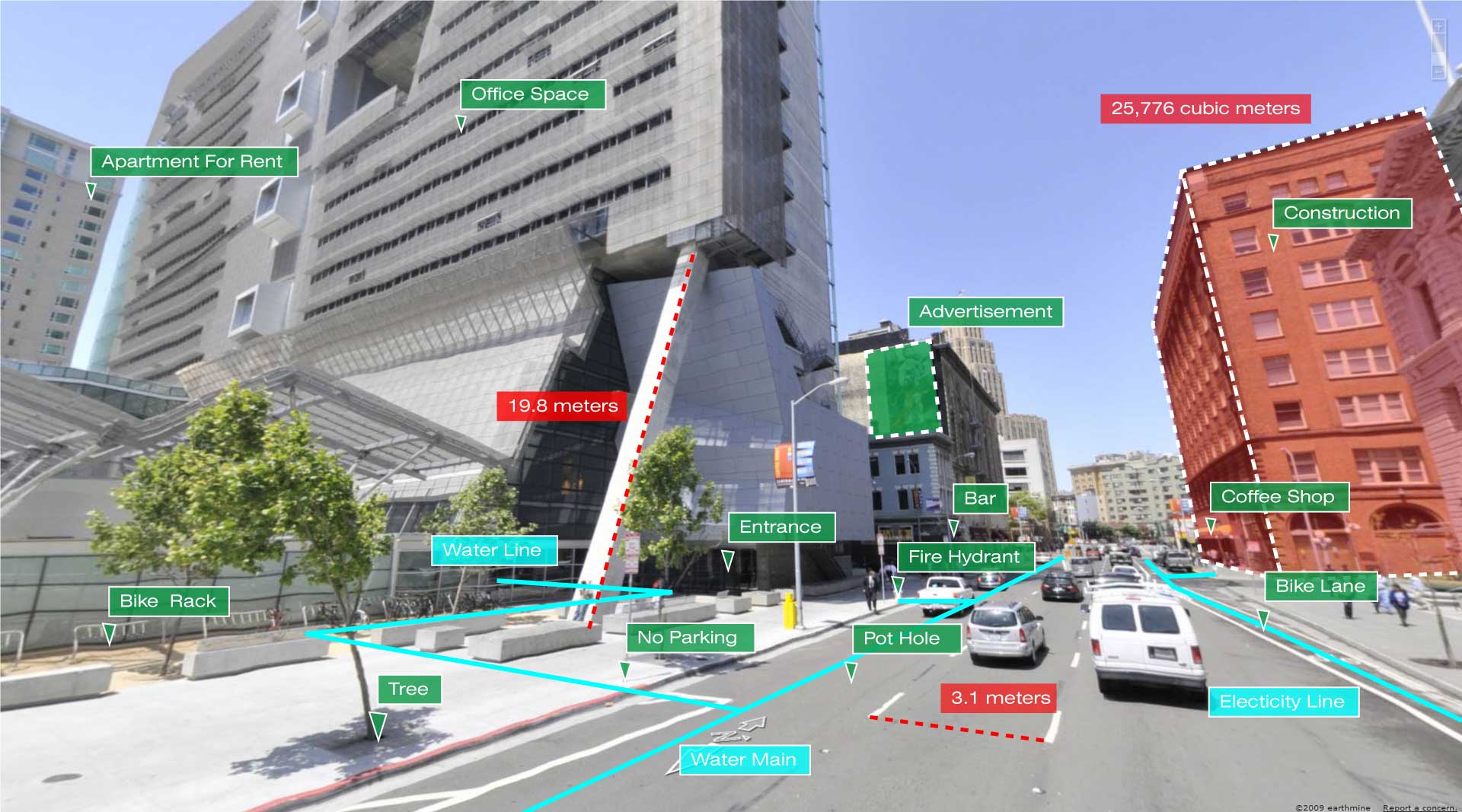
Earthmine 2009
This is an extract from 100 Ideas that Changed the Web, available on Amazon UK and Amazon US.
Pingback: Whewell’s Gazette: Year 2, Vol. #49 | Whewell's Ghost
Pingback: 70% of Digital Transformation of Banks Fail! Why Did This Happen and How to Avoid? – Site Title